Soil Site Details: Fort Langley Brunisol
Soils on this site are Brunisols. Brunisolic soils are relatively young, and can be viewed as an early stage in the evolutionary sequence of soil development, starting with unweathered parent material and ending with a mature soil (e.g., Podzol). The name Brunisol originated from the French word brun meaning brown.
Basic Facts
Soil Order: Brunisol
Ecosystem: Mixed Forest
Climate Zone: Humid Maritime
BC Biogeoclimatic Zone: Coastal Western Hemlock
Location: Fort Langley
City, Region, Country: Lower Fraser Valley, British Columbia, Canada
Lat / Long: 49.1675/ -122.572
Soil Order: Brunisol
Great Group: Melanic Brunisol
Subgroup: Gleyed Eluviated Melanic Brunisol
Soil Series: Fairfield
Classification Code: GLE.MB
Soil Horizons Present: Ah, Bm, C
Diagnostic Horizon 1: Bm
Diagnostic Horizon 2:
Diagnostic Horizon 3:
Diagnostic Horizon 4:
Land Form: Fluvial
Parent Material: Sandy to loamy sand fluvial deposits
Elevation (m): 8
Topography: Inclined
Affected by Glaciation: Yes
Climate Zone: Humid maritime
Mean Annual Temperature (C): 10
Minimum Annual Temperature (C): 6.5
Maximum Annual Temperature (C): 13.7
Mean Annual Precipitation (mm): 1200
Current Land Use: Agricultural, cultivated field
Original Vegetation: Riparian Vegetation
Current Vegetation: Annual agricultural crops
PDF with details: 14_Fairfield.pdf
Soil texture horizons: Coarse sand (all horizons)
Soil structure horizons: Weak granular (Ah), Structureless (Bm and C)
Forest Humus Form:
Presence of Charcoal:
Presence of Coatings:
Primary Soil Process: Leaching
Secondary Soil Process: Transformation
Links
Resources home: Principles, Land use, awareness, etc.
Processes: Brunisol
Classification: Brunisol
Virtual soil monoliths: via the left-side expanding menu.
Media
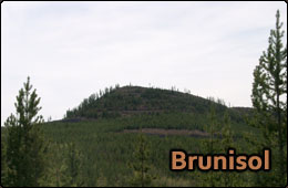
Brunisol, from https://processes.soilweb.ca/brunisol/.
Featured Expert: Dr. Christine Cross
Video host: Dr. Art Bomke